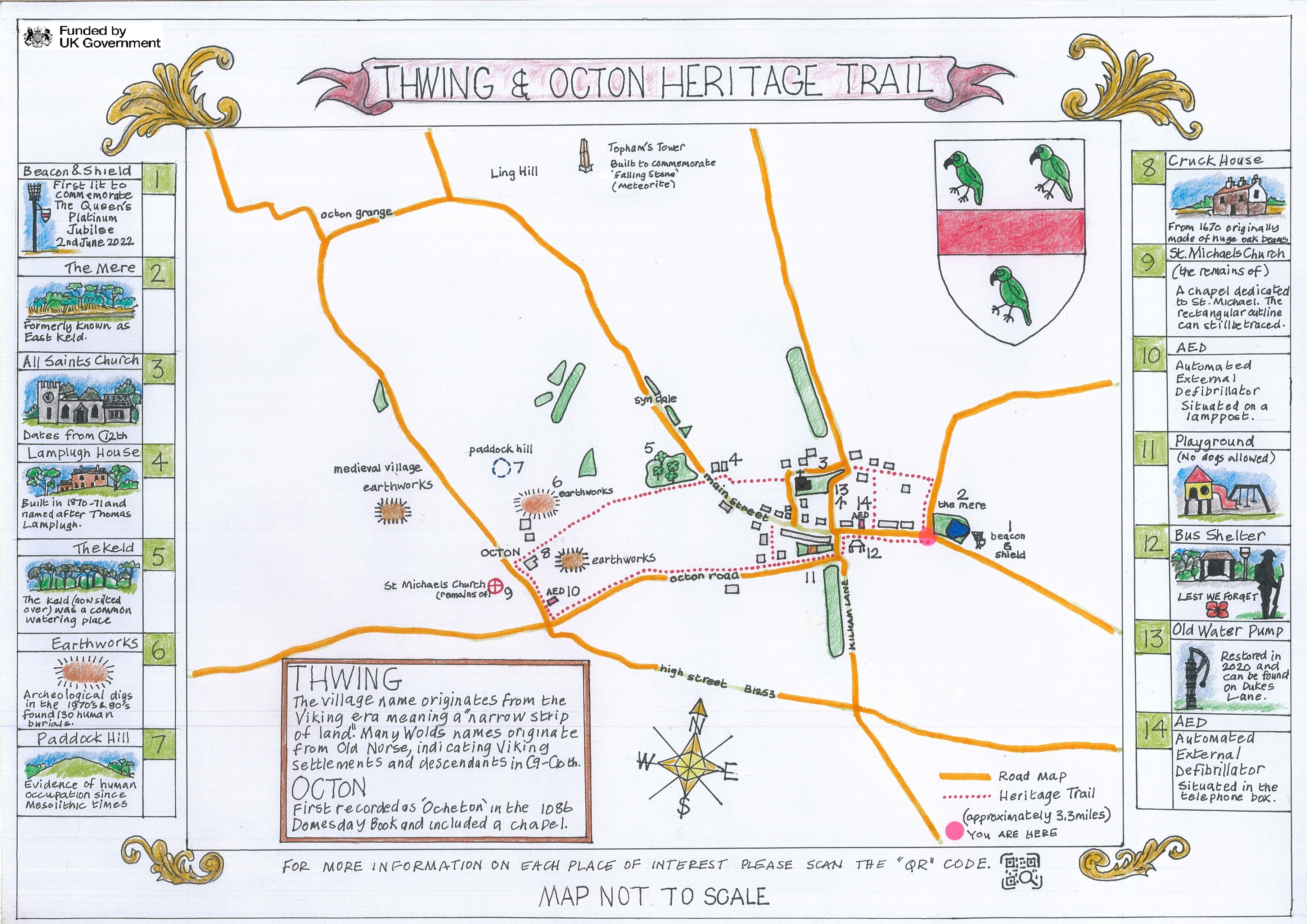
 Caption: Heritage Trail Map
Introduction
THWING is a small village, lying 300-350ft above sea level, on the eastern end of the beautiful East Yorkshire Wolds. Together with its associated hamlet of Octon-cum-Octon Grange, it forms a parish four miles long, covering 4024 acres and situated between 300 and 540 feet above sea level.
The parish is aligned from the tumulus known as Willy Howe in the east to a prehistoric earthwork in the southwest, and bounded by the Gypsey Race valley in the north and a Roman road (the High Street B1253) in the south.
The internal boundary between Thwing and Octon follows the dry valley of Syn Dale, with the village of Thwing lying in the uppermost end of the dale.
The pattern of field in the parish has remained largely unchanged from the Inclosure of 1769, and the free draining wold soil with its underlying chalk subsoil is ideal for cereal growing.
Originally Thwing was also associated with the village of Swaythorpe, which was largely depopulated during the 14th century black death. Swaythorpe now consists of one large farm, but with the ancient foundation of houses and the church are still distinguishable in a neighbouring grass field.
History shows that another ancient, extinct village was also associated with Thwing, namely Fornestorpe.
The parish registers commence in 1691, and under the date 7th May, 1809, record the burial of "Elizabeth Dawson, widow, of Kilham, aged 1
THWING:
Geographical and Historical information from the year 1892.
The population in 1881 was 439, and in 1891, 367.
The village of Thwing, which contains many well-built houses, stands on high ground about eight-and-a-half miles west-by-north from Bridlington, and four miles from Hunmanby.
The church (All Saints) is an ancient edifice of stone, consisting of chancel, nave, north aisle, south porch, and a small embattled western tower containing a clock and two bells. Four pointed arches springing from octagonal pillars separate the nave from the aisle. The chancel arch is semi-circular, and rests on piers with beautifully carved capitals."
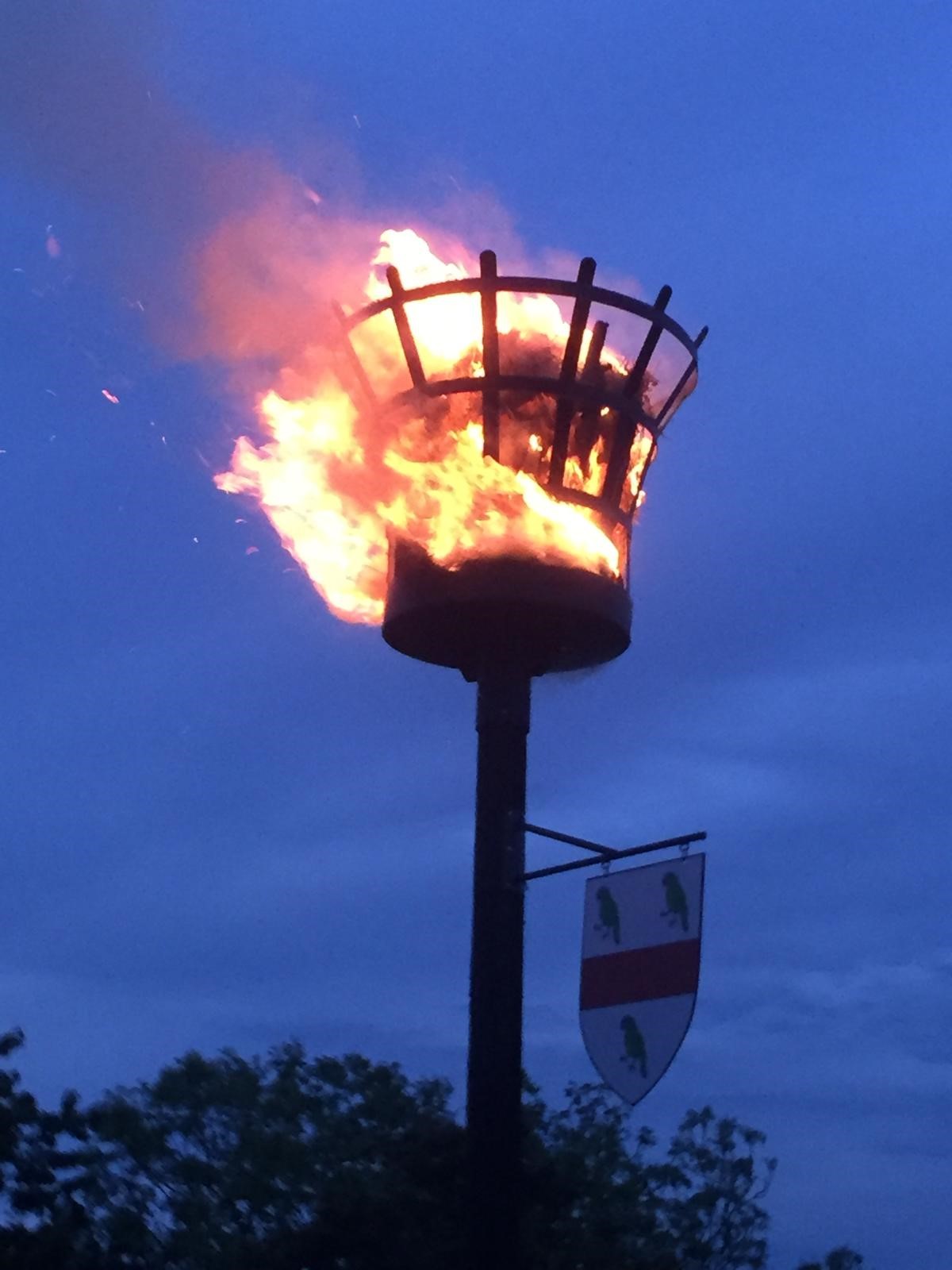 Caption: Beacon and Shield
1. Beacon and Shield
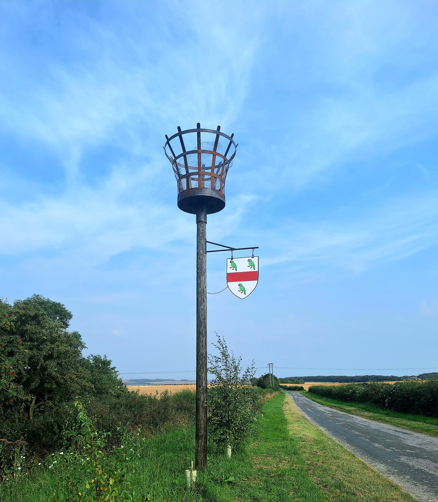
Thwing Beacon was installed in May 2022 prior to the Jubilee of Elizabeth the 11 on the 2nd June 2022. The Beacon pole was blessed by Reverend Start Grant and is dedicated as a memory pole. Small brass plaques, in memory of loved ones, can be fitted to the beacon pole. For further details please contact the parish clerk.
The Shield displays the coat of arms of the Thwenge Family, which has been adopted as the village identity.
History
The lordship of Thweng was held at an early period by a family that took its name from the place. Subsequently, by marriage with the Bruces, they obtained the lordship and castle of Kilton, which place thenceforth became their chief residence. The family was amongst the most distinguished in Yorkshire. The first of the name of whom we have any record is Sir Robert de Thwenge, who, in the reign of Henry III, was deputed by the other barons to repair to Rome, there to lay at the foot of the pope a complaint from the nobles of England, regarding an encroachment upon their ecclesiastical immunities by the Holy See. His descendant, Marmaduke de Thwenge, distinguished himself in the Scottish wars of Edward I, and was by that king summoned to parliament as a baron. He obtained a charter of free warren in this and other manors;
Thomas, the last Baron Thweng of this family, died about the middle of the 14th century. He was rector of the church of Lythe, and inherited
 Caption: Beacon and Shield
the barony on the death of Robert, Baron de Thweng, his brother, also a priest, vicar of Thweng. William, the eldest brother and previous baron, died unmarried. Male issue thus failing, the estates were divided amongst the heirs of their three sisters. Lucia married Sir Robert de Lumley, of Lumley Castle, Durham, and Sir Marmaduke, their son, who inherited Kilton and Thwing in right of his mother, assumed the arms of the Barons of Thwing.
Sir Ralph de Lumley, his second son and eventual heir, was summoned to parliament as a baron in 1384. He fought under the Percy standard in the Scottish wars of Richard II., and was twice Governor of Berwick-upon-Tweed. After the usurpation of the throne by Henry IV, he joined the Earl of Kent in an insurrection for the restoration of the deposed King Richard, and was slain in a skirmish near Cirencester in 1400. He, with Thomas, his eldest son, was attainted, and his manors and castles were confiscated, but 11 years later the family honours and estates were restored in Sir John, a younger son. Marmaduke, the youngest son of Sir Ralph, is perhaps the most illustrious name in the family. He was educated at Cambridge and became a priest. Church preferments literally poured upon him. He was Chancellor of the University in 1417-18; Master of Trinity Hall, from 1429 to 1443; Precentor of Lincoln, 1425-27; Rector of Stepney, London, 1427, and Archdeacon of Northumberland in the same year. He was Bishop of Carlisle from 1429 to 1450, when he was advanced to the bishopric of Lincoln, but died the same year. He was also for some time Treasurer of England.
Thweng remained in the possession of the Lumley’s till the reign of Henry VIII. John, Lord Lumley, was one of the chief actors in the Pilgrimage of Grace, and was one of the deputation to treat with the Duke of Norfolk on the banks of the Don. He was included in the list of insurgents to whom pardon was granted; but shortly afterwards in consequence of the non-fulfilment of the king's promises, George, his only son, engaged in a second conspiracy, with Sir Francis Bigod, Lord Darcy, Sir Thomas Percy, and others, was executed for high treason at Tyburn. Sir George left a son, John, who was born at Thwing, and succeeded his grandfather in 1609, but the barony was forfeited by the attainder of his father.
[Description(s) from Bulmer's History and Directory of East Yorkshire (1892)]
 Caption: The Mere
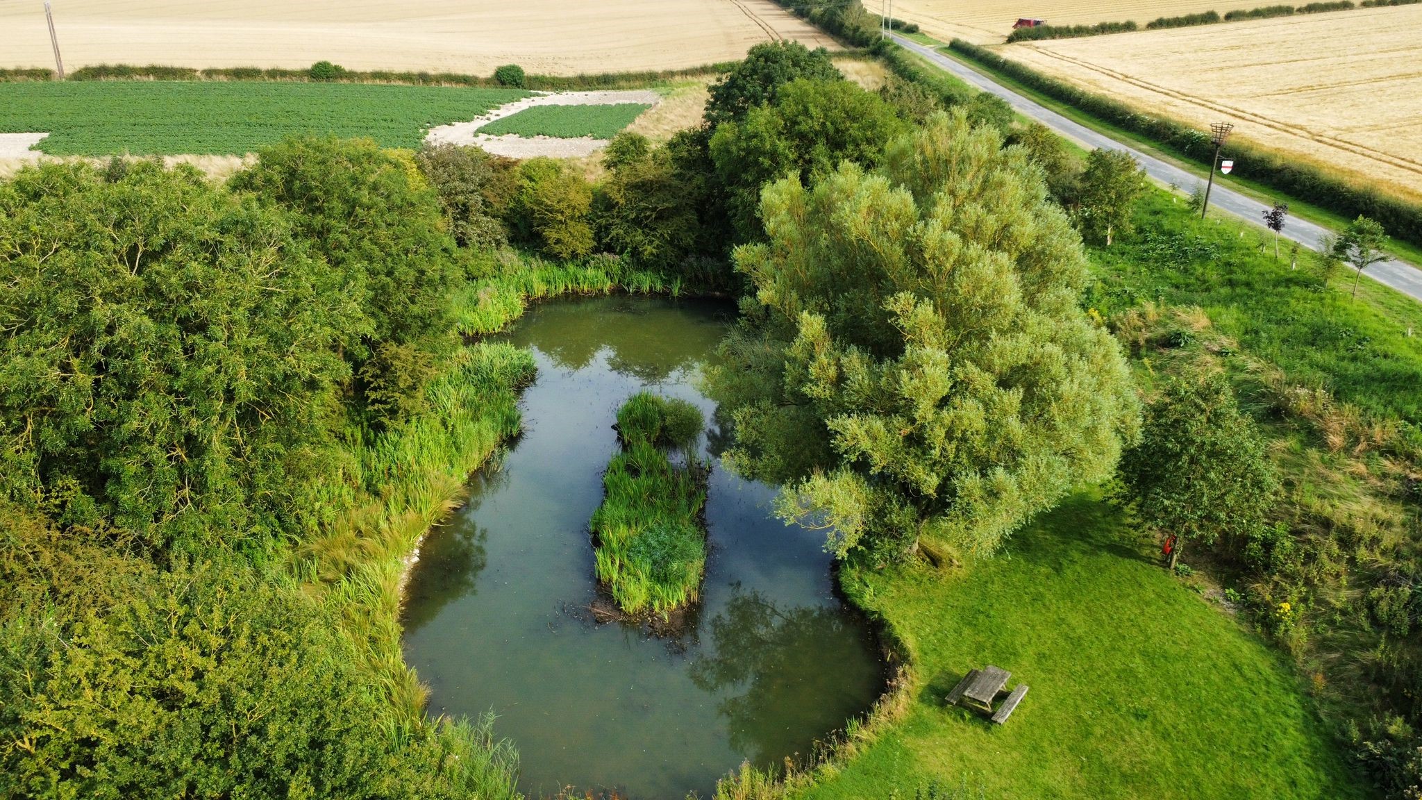
2. The Mere
There is a series of ponds and springs through the village including the Mere and the Keld. At the Inclosure the Mere was set aside to supply water for the village.
The Mere was partially cleared in 2000 when several trees were planted.
Thwing Mere (Formerly known as East Keld) is one of the parcels of land in the land section of Register Unit CL69 (ER) in the Register of Common Land maintained by The East Riding of Yorkshire
The area known as East Keld was awarded, allotted and assigned by the Thwing Enclosure Award, dated 18 September 1770, to the Churchwardens of the Parish of Thwing as a common watering place for the use of the owners and occupiers of lands and grounds within the townships of Thwing & Octon and Octon Grange.
The land awarded to the Churchwardens was transferred to the Parish Council by section 6(1) (b) and 6 of the Local Government Act 1894
Following our Community Plan in 2017, and thanks to funding support from The Peoples Postcode Local and Lisset Wind Farm Fund the Parish Council have once again restored the Mere and created a recreational area on the section of ground between the Mere and the Bridlington Road, whilst leaving a natural wild life habitat to the rear. Some trees have been cut back, and new trees planted along the road side, around the Mere banks. The Mere itself has been de-silted and a good part of the overgrown reeds removed. Thanks to additional funding from The Year of Green Action, bird, bat and bug boxes have been installed. Funding has also been granted from Tesco Bags of Help and The Postcode Local Fund. Thousands of daffodil bulbs have been planted on the upper banking, along with the new trees. Benches have been added and the Mere is now a popular area for villagers and the wider community to enjoy.
Adjacent to the Mere you can see the old tank track, which is reinforced with concrete and was laid in just half a day to assist tanks negotiating the steep bank, during World War 1. The Wolds were used as a training ground by the 11th Armoured Division, and the track is still in use today by farm vehicles.
In March 1942 a Halifax bomber crashed near Thwing Mere. The log says it took off 12 Mar 1942 from Middleton-St. George but collided with a dispersal platform losing part of the undercarriage. Evidence suggests that the plane was part of the 76 Squadron leaving on an operation flight attacking Essen in Germany
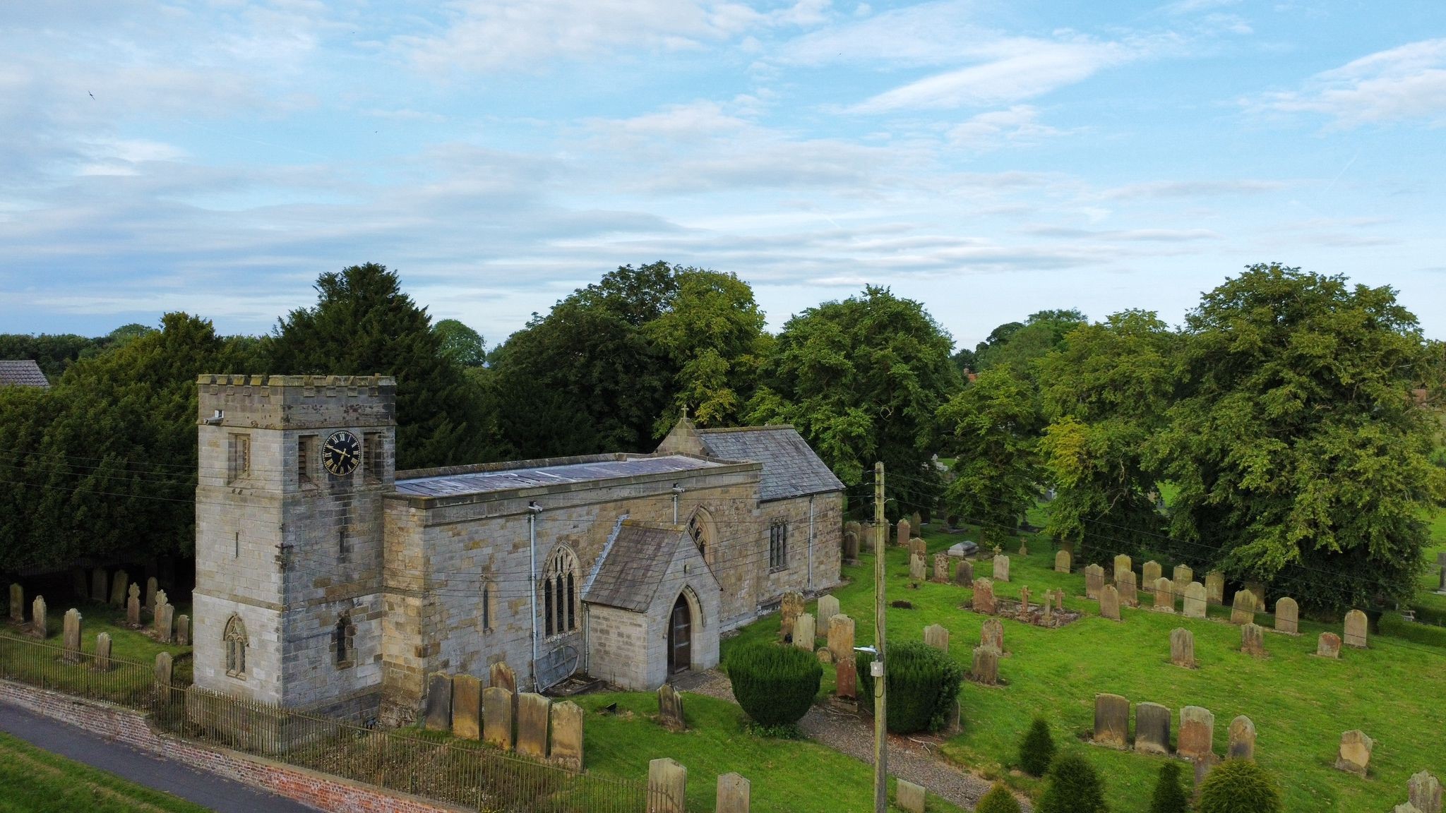 Caption: All Saints Church
3. All Saints Church
The benefice of Thwing was a rectory of two mediates from the 13 century. One in the patronage of the Lords of Thwing and the other given by John de Harpham to the Bridlington Priory, each with its rector until the Dissolution when the advowson passed to the Crown.
There is an unbroken series of over 80 rectors from 1180 to the present time.
Our beautiful church of All Saints is in the Diocese of York. The church dates back to the 12th century and retains several features of the original Norman construction, but the prevailing style of the architecture is that of the 13th and 14th centuries. The chancel arch is typically Norman with plain shafts and carved capitals. The south doorway is of the same period with shafts with spiral ornamentation and carved capitals, and a well-preserved tympanum with a carving of the Paschal Lamb below a zig-zag arch. The Norman font with it's lozenge-shaped pattern is reputed to have come from Sewerby and was installed at Thwing in the early 19th century. The north aisle of the church was added in the late 13th century and extended to accommodate a chantry dedicated to St Thomas a Becket. It is separated from the naïve by an arcade of five piers. Within the arcade is a recumbent effigy of a priest holding a chalice and thought to be that of Thomas, last baron of Thwing.
The window in the south chancel is of great interest. It depicts the arms of the Archiepiscopal see of York, those of the ancient barons of Thwing, and the house of Lumley, lords of the manor. The S.E. nave window is an original three-light 14th-century window with a tomb recess below it.
The south porch was erected as a memorial to Archbishop Lampugh and incorporates a 14th-century stoup and fragments of ancient carvings.
A carved oak pulpit with brass candelabra was added in 1910 and the brass lectern was a gift from Sir Tatton Sykes at about the same time.
The church has two bells, one installed in 1720 and made by Samuel Smith, and the other in 1762 made by E. Seller, both of York.
The church clock is very rare, with a special escapement for accuracy. It was made by James Harrison circa 1840, of the same family of John Harrison who invented the chronometer.
Source: Thwing handbook Churches of the Yorkshire Wolds (2)
The church was re-pewed in 1814, by the parishioners, and thoroughly repaired in 1836, at the expense of the late Robert Prickett, Esq., of Octon Lodge, who was then lord of the manor. The east window consisting of five lights and oriel of 24 lights, was erected by the late Mr. Prickett, and exhibits the arms of the Archiepiscopal see of York, the ancient barons of Thwing, the noble house of Lumley, and the donor himself, who died in 1844, and to whom there is a marble tablet on the north wall of the chancel. On the opposite wall is a large and handsome marble monument, erected by Mr. Prickett, commemorating the learning and virtues of Thomas Lamplugh, Archbishop of York, who was born at Octon Grange in this parish, and died in 1691. Within the altar rails is a monument with a full sized recumbent effigy, supposed to be that of Thomas, last Baron de Thwing, and Rector of Lythe, who died in 1374, when the barony fell into abeyance. Affixed to the wall on the north side of "My Ladie's Aisle" is a small brass, commemorating Robert Stafford, Esq., "a Servant of the Lord." There are also tablets to various members of the families of Lowish, Vickerman, and Topham. The communion service was presented by Archbishop Lamplugh and is still in use. The font is ancient. Within the porch above the doorway is an ancient piece of sculpture representing the Agnes Dei or Lamb of God. The living is an ancient rectory which was formerly held in separate medieties called Thwing and Octon, each valued in the Liber Regis at £8 12s. 1d. The patronage of the former mediety belonged to the Barons Thwing, afterwards to the Lords Lumley; and the patronage of the latter to the Prior and Convent of Bridlington, to whom it was given by John, son of John de Harpham. In the reign of Henry VIII, both medieties reverted to the Crown, - Thwing by the attainder of Sir George Lumley, and Octon by the dissolution of Bridlington Priory. They continued to be held by separate rectors until 1667, when Robert Constable was appointed to both medieties. In 1748 the two were consolidated and so remain. It is in the gift of the Lord Chancellor, who presented the Rev. William Felton, M.A., of St. Aidans, the present rector, in 1883. The net value is £650, with residence, which is derived chiefly from 556 acres of glebe. The tithe rent-charge is £53. "There was" says Torre, "a chapel in this church of Thweng, dedicated to the honour of St. Thomas the Martyr, in which was a chantry founded by Thomas de Thweng, rector of the Church of Lytham."
NB: The Church rooms are located on Church Street below the church, and are now used as parish rooms. The rooms were originally a school house with the adjacent house being the school masters residence. On the opposite side of Church Lane on the nearby farmland stands the remains of a brick structure that is listed as a searchlight emplacement, but due to the height of the walls is more likely to be a blast wall that protected a timber high-frequency/direction finding (HF/DF) tower, which were used by the RAF to track both enemy and friendly aircraft during the war.
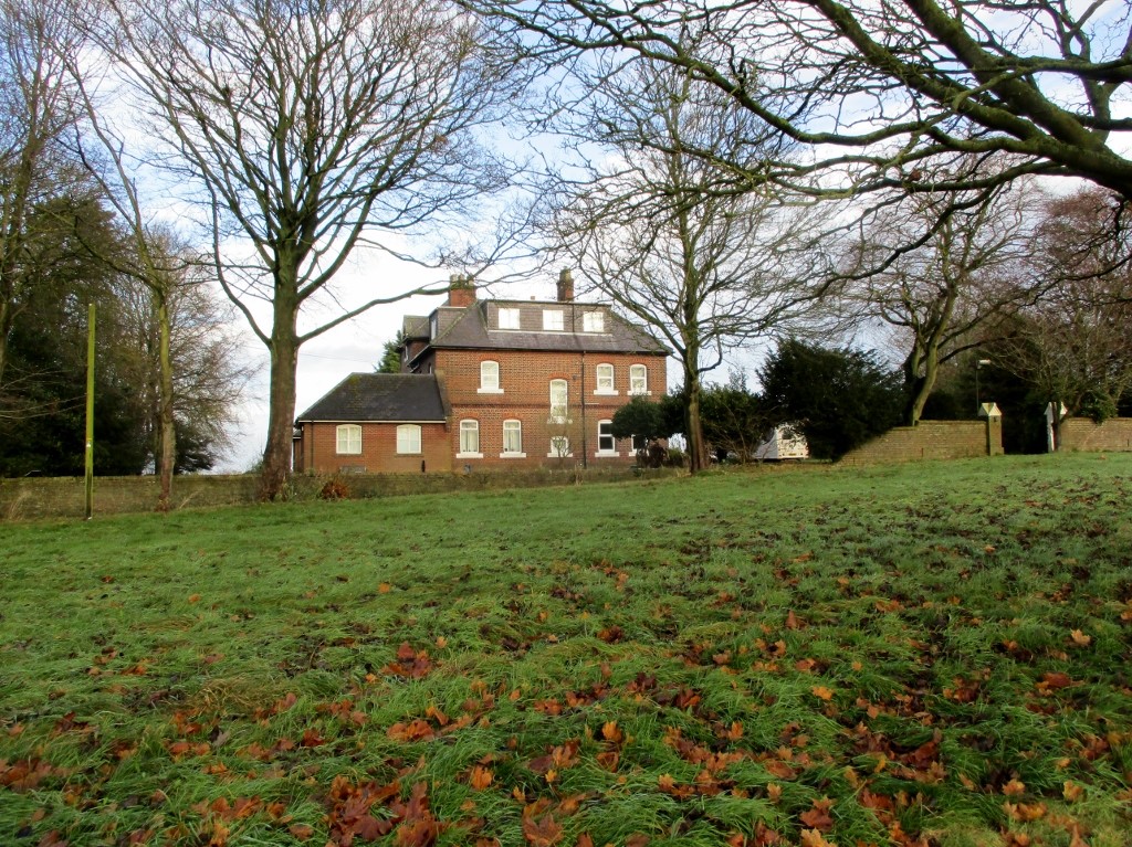 Caption: Lampugh House
4. Lampugh House
Built 1870-1, it is named after Thomas Lamplugh who was born at Octon in this parish in 1615 and became Archbishop of York in 1688. He died in 1691 at Bishopthorpe and is buried in York Minster. A plaque on the south chancel wall of Thwing Church is a tribute to him.
The House was originally the rectory of Thwing and opened as a Christian conference centre for young people in 1973 by the then rector of Thwing. It was then used as a retreat house for some years by the Kingdom Faith Church which was formed in 1992 by the former Anglican vicar turned itinerant preacher, Colin Urquhart. Regular weekly meetings, retreats, and healing revival weekends were hosted.
It reverted to private ownership in 2015
5. The Keld
The Keld (now silted over), was the common watering place, and was included in the rector's allotments.
As one of the parcels of land in the land section of Register Unit CL69 (ER) in the Register of Common Land maintained by The East Riding of Yorkshire. The Keld was awarded, allotted and assigned by the Thwing Enclosure Award, dated 18 September 1770, to the Churchwardens of the Parish of Thwing as a common watering place for the use of the owners and occupiers of lands and grounds within the townships of Thwing & Octon and Octon Grange.
The land awarded to the Churchwardens was transferred to the Parish Council by section 6(1) (b) and 6 of the Local Government Act 1894, but is now under private ownership.
6. Earthworks
An aerial survey in 1967 showed a concentric cropmark of a Class 2 Henge Monument, at the site at Paddock Hill which is part of the present day Octon Manor. Activity has been recorded from the Middle Stone Age, 6000 B.C. to 4000 B.C. A massive circular fort surrounded by a deep ditch and chalk rampart, with palisade and opposite gateways, from the Bronze Age. Anglo Saxon occupation around 700AD with signs of a large rectangular structures with hearths, metal working debris and ovens. Within the area was also a cemetery of shallow graves.
During the dry summer of 1979 squares and roundels were clearly visible in the field known locally as Dotteril Flats some half a mile due east of Swaythorpe.
At Octon Grange a mile north west of Octon, there are two 19th century farmhouses today, but earthworks mark the site of the former grange established by Meaux Abbey.
Both Swaythorpe and Octon had windmills in the 13th century.
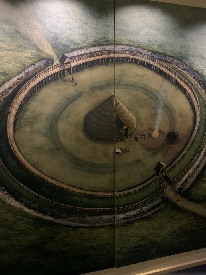 Caption: Paddock Hill
7. Paddock Hill
Artist impression of final phase of The Henge From a painting in Hull and East Riding Museum
As you reach the end of the path with Glebe Farmhouse on your left you can turn right. The road heads in a north-westerly direction, down past Octon Grange and then climbs Paddock Hill. As you approach the top of the hill the village of Wold Newton comes into view to the north-est. You will see a field boundary to your right and a small wood to your left.
Paddock Hill has produced evidence for human occupation since Mesolithic times (c. 10,000BC-c. 450BC) and is the only known major site from the 6th century Saxon kingdom of Deira.
In the field just in front of the tree boundary on the right is the site of a circular henge, occupied between the early Neolithic and late Bronze Ages (c4500BC – c. 600BC). At its largest it comprised ditches and ramparts, fortified with timber posts, with entrances on either side, enclosing a large timber building. The site was also used during the Anglo-Saxon era (c.410AD – 1000AD) and seems to have included several large timber buildings.
Archaeological excavations in the 1970s and 80s uncovered 130 human burials from this period. Following the completion of the investigations the remains were re-buried and a unique burial service was conducted by the Archbishop of York.
The lengthy Octon dig (approx. 12yrs) yielded information about the Stone Age, Bronze Age, Roman-British and Middle Age cultures.
 Caption: Cruck House
8. Cruck House - The Old Farm House
Photo from Historic England
Fornestorpe and Octon formed a berewick or small part of a manor of Thwing.
At Octon Grange, a mile northwest of Octon there are two 19th century farmhouses, and earthworks that mark the site of the former Grange which was established by Meaux Abbey.
Archaeological excavations carried out in recent years have shown evidence revealing signs of occupation at various times from Neolithic man to the Middle Ages.
The Old Farmhouse at Glebe Farm is of great importance as an example of a farmhouse on the Yorkshire Wolds built before the mid -18th century. Between 1600 and 1750 wholesale rebuilding of farmhouses and cottages took place in the East Riding. Two of the earliest surviving cruck framed houses in the East riding are at Octon and South Dalton. The two cruck trusses at Octon follow the usual form found in North Yorkshire. At the apex the cruck blades are tenoned into a saddle that supports the ridge piece. Each truss has a tie beam and a collar, both halved over the blades and pegged. The houses are of the hearth passage plan, a development of the longhouse plan. Initially the open-hearth was moved from a more central position to back on to a through passage which links the front and back doors and divides the humans from the animals an storage. **
Very few of these buildings now remain, and none is as complete or unaltered as the Old Farmhouse at Octon. The timbers used in Octon crucks were felled in 1670. The building underwent extensive restoration in 2013.
** Yorkshire & York & The East Riding Nikolaus Posner & David Neave.
THWING OCTON THE OLD FARMHOUSE, GLEBE FARM (Formerly listed as: OCTON COTTAGE AT GLEBE FARM)
Longhouse, former yeoman's farmhouse, late C17.
MATERIALS Oak cruck frames; chalk walling, outer cladding in slim, handmade brick mainly laid in stretcher bond; pantile roofs.
PLAN Single storey longhouse of three cells with the byre end to the south. The cross passage wall to the byre has been removed, but the opposed entrances remain, with the byre latterly used as a kitchen. The stair, to the inserted attic floor, rises alongside the east wall of the central room (the housebody). The northern bay, beyond a timber partition, forms a parlour. The attic is divided into three rooms. At the foot of the stair there is a doorway to a single bay outshut, whose only other opening is an external door. Attached to the north end of the longhouse there is a single bay outbuilding (wash-house).
INTERIOR Crucks: The longhouse retains two in situ base cruck frames complete with saddles and collars, the lower parts of the crucks being built into the chalk walling. The blades of the northern cruck are a matched pair split from a single timber. Its collar is halved onto the south side of the blades and secured by single pegs. Both blades are mortised into the saddle, each being secured by two pegs. This saddle supports a block which in turn supports a diamond set ridge beam. Purlins, (which are later replacements) are trenched into the backs of the blades. The southern crucks are an unmatched pair, the east blade being relatively straight, but elbowed just below the collar and with a replacement timber spliced into its base. The west blade is possibly double curved, but is largely obscured by plaster. Again the collar is halved into the blades which are in turn morticed into the saddle, with each joint secured by two pegs. Dendrochronology analysis of the blades and collars show that both trusses include timber from a single tree felled in the winter of 1670. Housebody: The central bay or housebody is separated from the southern bay by a chalk wall incorporating the chimney, and from a former parlour to the north by a plank and muntin partition, with similar panelling dividing off the staircase that rises alongside the east wall. The area beneath the stairs has been interpreted as the remains of a box bed. Set just to the south, and probably predating the partition, there is a beam that has an ogee and stepped moulding on the south side and a hollow chamfer on the north side. Nearly all of the other joists supporting the inserted attic floor are sawn soft wood, some with C19 roll mouldings, and some being simply chamfered. Floor boards are also pine, with those of the southern bay being broad. The housebody has a C19 cast iron fireplace served by an inserted brick stack in the place of the earlier hearth, screened from the doorway to the byre end by a plank partition. There is a plank door at the foot of the stairs hung on C18 strap hinges and a similar door to the parlour hung on butterfly hinges.
Parlour: This retains a simple, Regency period timber chimney piece, although the fire surround has been lost.
Kitchen: This is served by an inserted brick stack on the south gable wall. The chalk wall to the north includes a brick lined alcove or former cupboard.
Attic: Both of the cruck frames include remains of stud, lath and plaster partitions dividing the attic into three rooms. The southern partition retains remains of the former wattle and daub smoke hood.
HISTORY The Old Farmhouse at Octon, a hamlet in the historic parish of Thwing, is dated to shortly after winter 1670, the felling date of the timber in the cruck trusses. Originally, the building probably had walls constructed of wattle and daub or other similarly insubstantial material, with the chalk walling being an early alteration. Thwing parish baptismal records of 1692 and 1696 suggest that the house was then owned and lived in by a yeoman, John Roper. John Roper mortgaged the farm in 1720 and then sold it in 1723 for £350 to the Vicar of Folkton as glebe land, giving the farm its current name. At this time it included the house with three adjoining closes together with 10 oxgangs of land within Octon's open fields (an oxgang originally being an area of land that could be cultivated with a single ox). Octon's open fields were enclosed by Parliamentary Act in 1769, with the vicar of Folkton being awarded enclosed land on either side of the farm house totalling just under 100 acres. This consolidation of land may date the encasement of the house with brickwork, although this may have been one of a number of minor improvements that appears to have been made to the house earlier in the C18. In 1856, the glebe land of Folkton was transferred to the vicarage of Burton Fleming. The farm was sold by the church to the Burdass family in 1921 who moved into a new farmhouse just to the north in 1939, turning the Old Farmhouse over to storage.
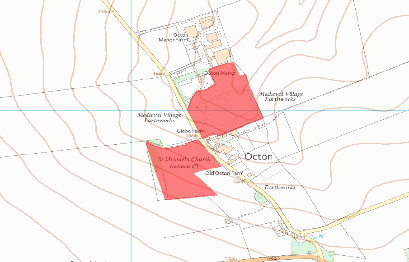 Caption: Map showing St Michaels Church
9. St Michaels Church
OCTON and Octon Grange form a joint hamlet, containing about half-a-dozen farmhouses, about one mile west from Thwing. The hamlet, with its manor, belonged to the Thwengs, one of whom, Robert de Thweng, married the widow of Sir John de Oketon. Sir William de Thwenge, Knt., in 1327 founded a chantry here, in the chapel of St. Michael, wherein mass was to be offered up for ever for the soul of Sir Marmaduke Thwenge, his father, his own soul, and the souls of his ancestors. The endowment consisted of four oxgangs and three acres of land, and the chaplain received, in addition, two marks per annum from the rectors of Thwing
[Description(s) from Bulmer's History and Directory of East Yorkshire (1892)]
Standing facing the road with the cruck farmhouse directly behind you, the field in front of you contains the distinctive lumps and hollows of vanished medieval village buildings.
Octon is first recorded (as) chiton) in the Domesday Book of 1086, and grew to include a chapel, dedicated to St Michael, whose rectangular outline can still be traced.
To the right of the field is a Holloway, an ancient track running roughly east-west: heavy use over the centuries has eroded the surface of the track so that it is now at a level well below the fields that flank it on either side. ***
*** Source Historic England Listing 1309563
10. AED
Located on the lamp post at the top of Octon Grange Road installed by the Parish Council in 2018. Listed on the Circuit
11. Playground
The children’s play area was installed in 2012 following a successful bid of grant funding from the national lottery. There is a variety of wooden pieces together with a goal end, for children to enjoy. The play area is maintained by a small voluntary committee in Thwing.
 Caption: Octon Bus Shelter
 Caption: Thwing Bus Shelter
12. Bus Shelter
Thwing Bus & Octon Bus Shelters
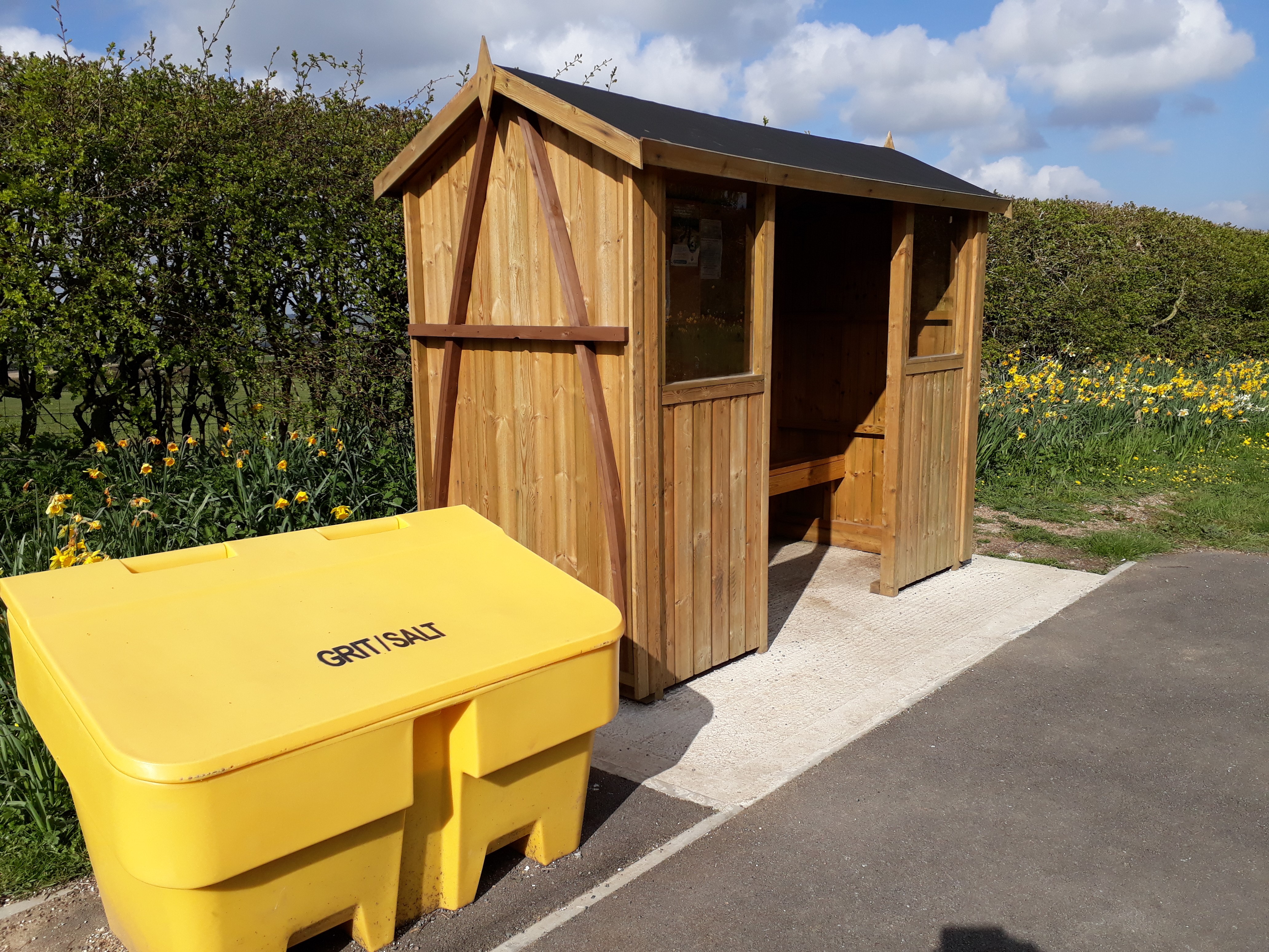
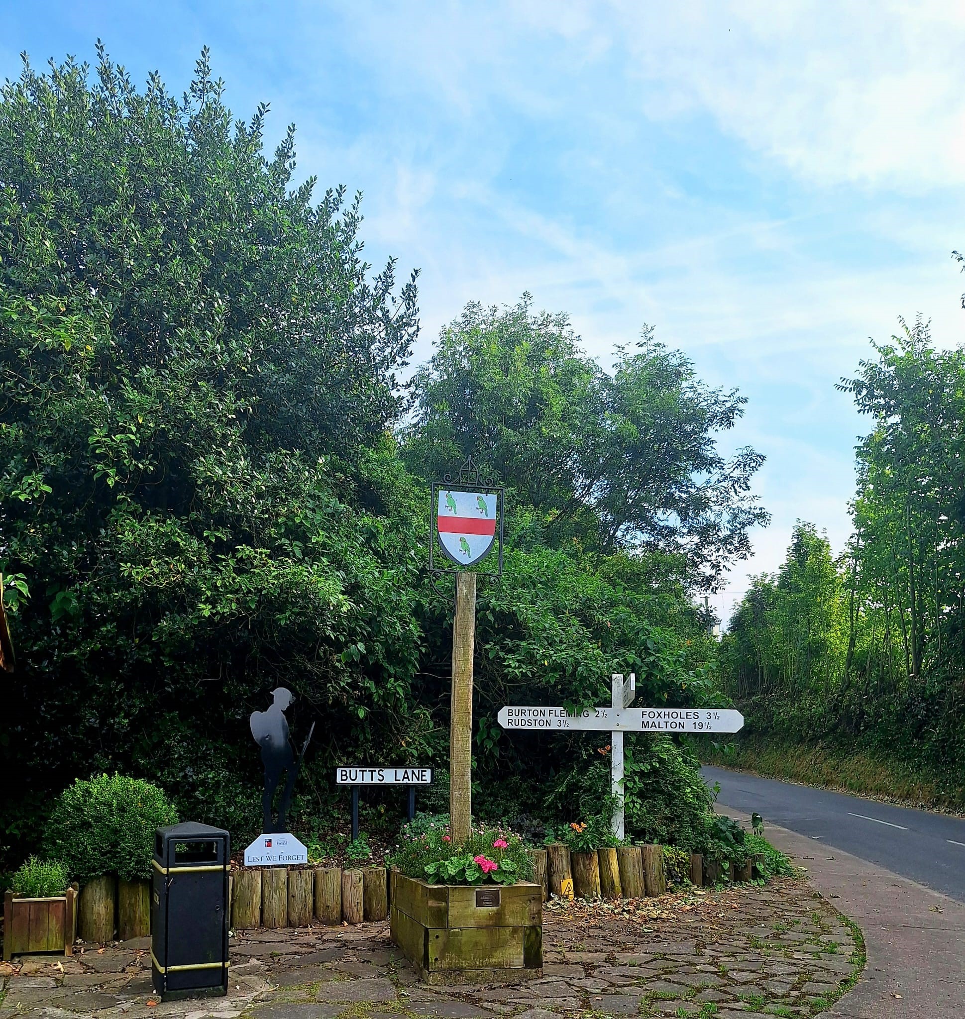
Two new bus shelters were installed in the village in 2017. Both shelters have seating and notice boards and give welcome shelter and rest for walkers and residents.
The Octon shelter has been designed in recognition of the cruck house in the hamlet, the old shelter having been relocated just around the bend as two pairs of Swallows nested here each year. Hawthorn and Sloe have grown out of the side of the old shelter providing spring flowers and autumn berries. A honeysuckle is planted to the side to provide scent and colour in the years to come.
The Thwing Shelter is located at the Crossroad adjacent to our village shield and remembrance area. The plaque on the planter was blessed by Rev Stuart and commemorates those who lost their lives in World War 1 and 11
 Caption: Old Water Pump
13. Old Water Pump
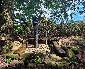
Little is known about the old village water pump which was used for household water before mains were installed in the village, was restored in 2021. The pump is a fine example of what was used at that time. There was also a village well situated on Main Street by the side of the disused red Telephone box, which now houses one of the two parish defibrillators. This well was used as the main water supply for the village, and water was accessed by a system of two buckets and ropes. The well was deep and when you looked down it you could not see the bottom.
14. AED
Located on Main Street in the old telephone kiosk, which is maintained by the Parish Council
 Caption: The Falling Stone
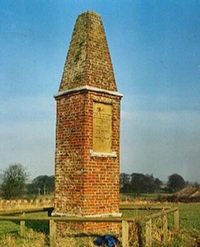
The Falling Stone (Tophams Tower) and Wold Cottage
WOLD COTTAGE is about two miles north of the village, formerly the residence of Major Topham, a well-known writer, and for several years editor of a newspaper called The World. Here, on the 13th of December, 1795, was observed a most extraordinary natural phenomenon - the fall of an unusually large meteoric stone. Major Topham has given the following account of it: - " It was on Sunday, about five o'clock, the 13th of December, 1795, that the stone in question fell two fields from my house. The weather was misty, and at times inclined to rain; and, though there was some thunder and lightning at a distance, it was not till the falling of the stone that the explosion took place, which alarmed the surrounding country, and which created so distinctly the sensation that something very singular had happened. When the stone fell, a shepherd of mine, who was returning from the sheep, was about one hundred and fifty yards from the spot; George Sawden, a carpenter, was passing within sixty yards; and John Shipley, one of my farming servants, was so near the spot where it fell that he was struck very forcibly by some of the mud and earth raised by the stone dashing into the earth, which it penetrated to the depth of 19 inches from the surface. While the stone was passing through the air, which it did in a north-east direction from the sea coast, numbers of persons distinguished a body moving in the clouds, though not able to ascertain what it was; and two sons of the clergyman of Wold Newton, a village very near me, saw it pass so distinctly by them that they immediately ran to my house to know if anything extraordinary had happened. The stone, in its fall, excavated a place of the depth before mentioned, and of something more than a yard in diameter. It was fixed so strongly in the chalk rock that it required some labour to dig it out. The breadth of the stone was 28 inches, and the length 30 inches, and the weight 56lb." To commemorate the event, Major Topham erected a column with the following inscription: - “Here, on this spot, Dec. 13th, 1795, fell from the atmosphere an extraordinary stone, in breadth 28 inches, in length 30 inches, and whose weight was 561bs. This column was erected by Edward Topham in 1799." The stone, or rather a portion of it, is in the British Museum.
Scientific Insights : The Wold Cottage meteorite is classified as an L6 ordinary chondrite, a type of meteorite that contains silicates and metallic minerals. This classification places it amongst the most common type of meteorites found on earth. The Wold Cottage meteorite ranks as the largest meteorite observed to fall in Britain and the second largest recorded in Europe. The minerals found in the meteorite provide insights into the processes that occurred during the formation of our solar system. Isotopic studies suggest that the meteorite formed approx 4.56 billion years ago..
[Description(s) from Bulmer's History and Directory of East Yorkshire (1892)]
Falling Stone Pub
The pub on Main Street sadly closed a few years ago, but it is named after the meteorite that fell on the edge of the parish near Wold Newton. Research shows that there has been a pub here since 1823 when it was called the Bottle and Glass and run by James Jordon. By 1879 it had been named the Rampant Horse. By 1893 the name had changed again to the Raincliffe Arms before once again changing it’s name back to the Rampant Horse.
Additional Photos can be found by following the below link, Kindly supplied by
EastWolds Community Newsletter
Photographs | East Wolds Community Newsletter